
60th Birthday Celebrations for Hugmanannygoat
Hash Notes by Scotch Tape and Mudman (runners trail)
Photos by Hugmanannygoat
Photos by Ballbanger
Photos by Bush Whacker (from the top of the hill)
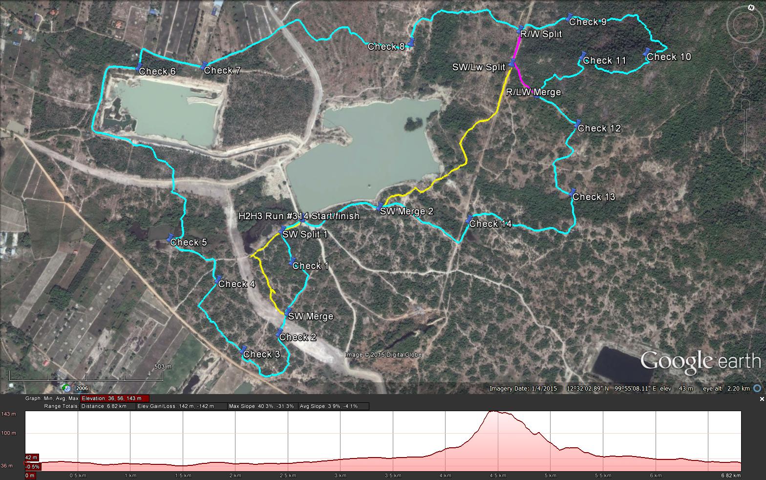
GPS scan of trails as laid by Tinks
Runners Trail (Cyan): 6.9 km
Elevation - Min 36 m Max 143 m, Gain/Loss 142.0 m.
Max slope - Ascent 40.3%, Descent 31.3%. (Not as steep as the Mudman Hill on 6/08/2011 which was 47.5% and 35.8% respectively)
Route went clockwise
Long Walk (Magenta): 5.7 km
Short Walk (Yellow): 5.2 km (Sorry Guys thought this was less than 5 km)
Hash Notes by Scotch Tape and Mudman (runners trail)
Photos by Hugmanannygoat
Photos by Ballbanger
Photos by Bush Whacker (from the top of the hill)
GPS scan of trails as laid by Tinks
Runners Trail (Cyan): 6.9 km
Elevation - Min 36 m Max 143 m, Gain/Loss 142.0 m.
Max slope - Ascent 40.3%, Descent 31.3%. (Not as steep as the Mudman Hill on 6/08/2011 which was 47.5% and 35.8% respectively)
Route went clockwise
Long Walk (Magenta): 5.7 km
Short Walk (Yellow): 5.2 km (Sorry Guys thought this was less than 5 km)
 RSS Feed