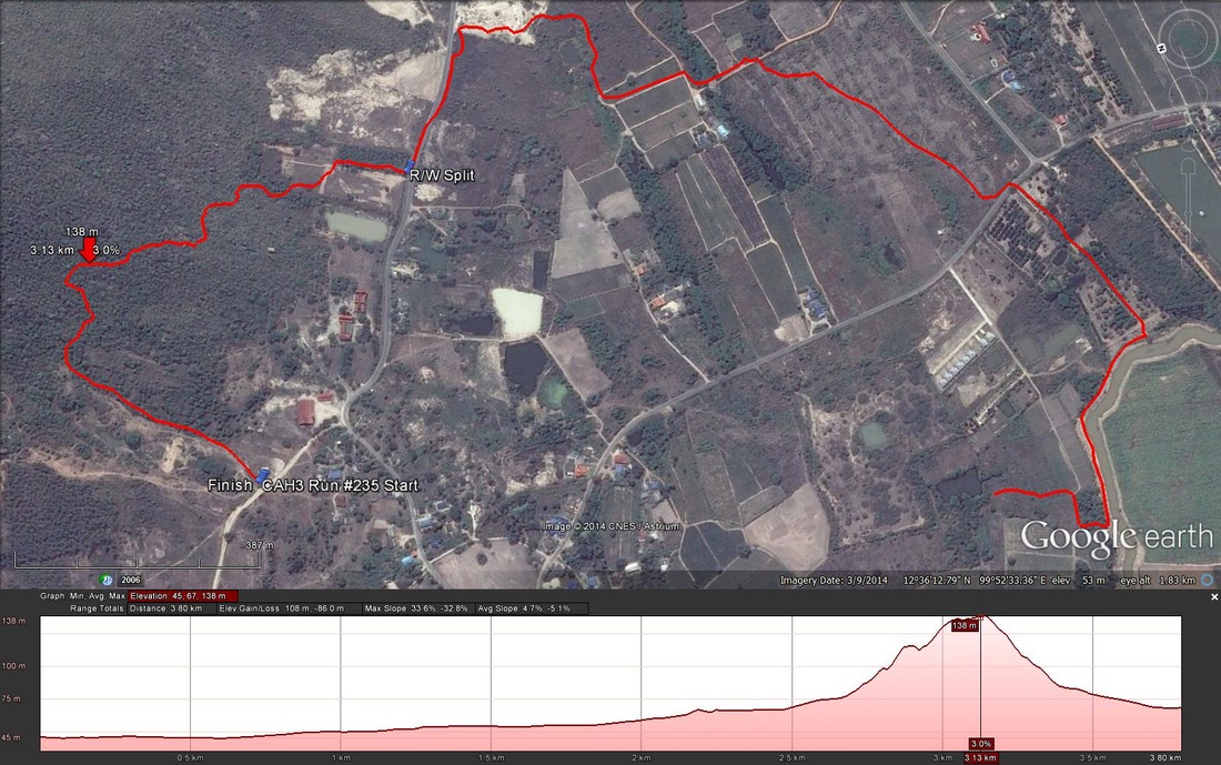
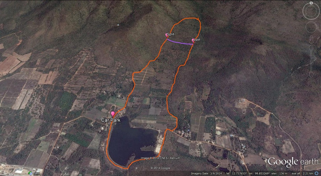
Fellow Hashers, Regrettably I forgot to switch on my GPS until 19 minutes into the Run. Yesterdays runners trail for me was around 5.9 km in around 68 min. For the part I did record the following data: Length 3.8 m in 49:.18 min. Elevation - Min 45 m Max 138 m, Gain 108 m, Loss 86 m, Max slope - Ascent 33.6%, Descent 32.8%. Route went anti-clockwise The runners loop was 1.3 km and took me 25:31 min. ON ON Tinks
0 Comments
GPS scan and following disclaimer supplied by Hugmannanygoat. Before Hugs was punished on the ice for his bout of verbal diarrhea, he did try to warn us of a discerning nature regarding the shape of the trail and would have suggested it be named "Bell End In The Valley" or perhaps more relevant "A Complete Cockup". The runners trail was 6.72km and the walkers 5.2km. The trail went in a clockwork orange direction. Clear here for pictures from Ballbanger. Click here for pictures from Damo. You Tube video proudly created by Hugmannygoat |
CHA AM
|