Hash Notes by Tinks
Photos by Cathusalem with notes as below
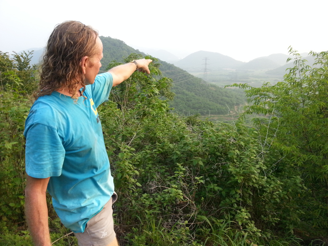
I took the photos because Hugs had forgotten his camera. I'd already decided that I'd like to climb Mudman's "Hill of Death" but taking photos slowed me down a little. However, if I'd been closer to the pack going up the hill, I might have gone back down when they encountered bees.As it turned out Mudman caught me up in his sweeping operation, which he rightly judged necessary because of the terrain. Fortunately, we didn't see any bees and climbing together enabled me to photograph the hare on top of his infamous hill
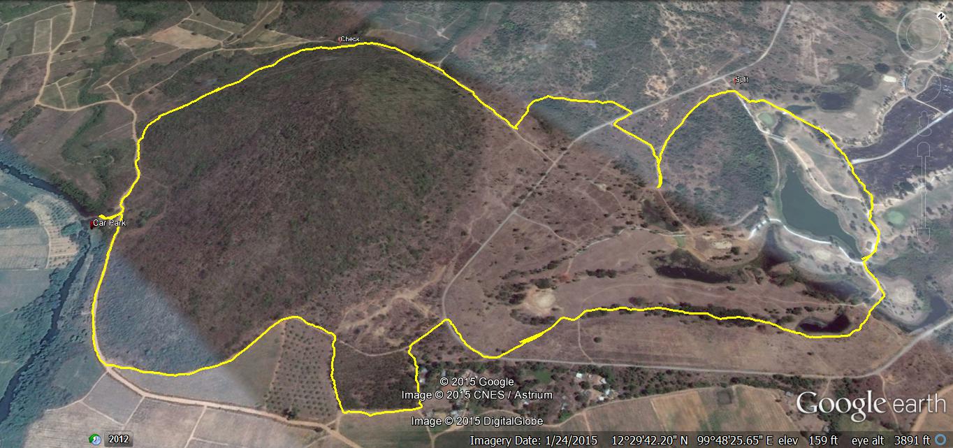
GPS scan of walkers trail by Hugmanannygoat.
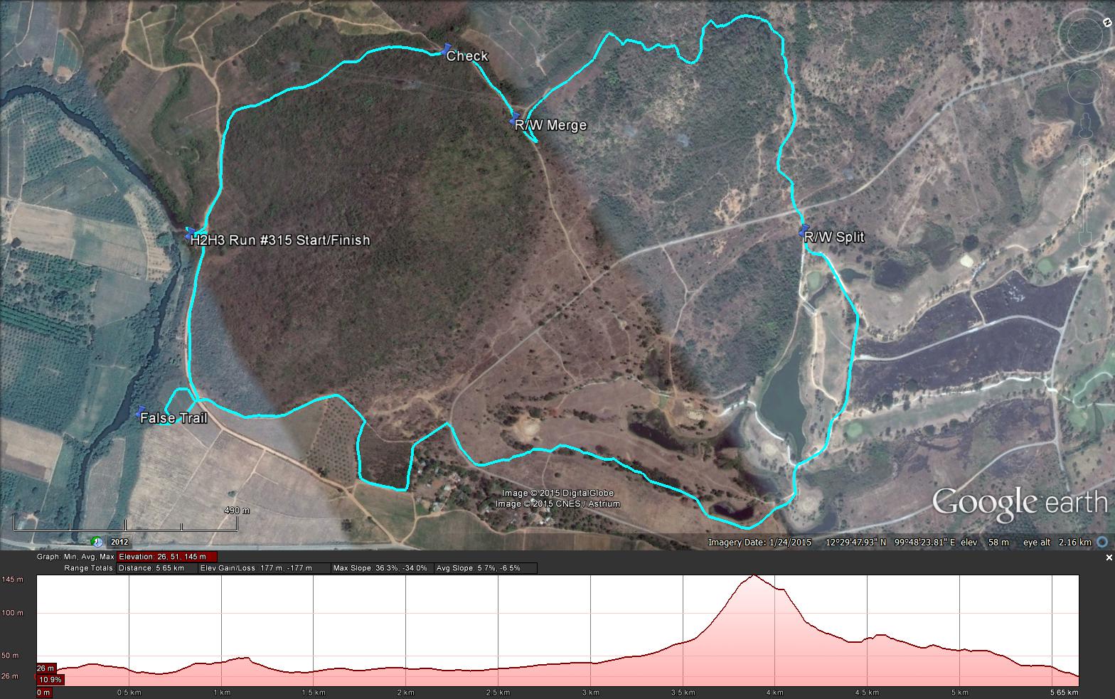
GPS scan of runnners trail by Tinks with notes as below
Yesterdays Runners trail for me was 5.7 km in 80:57 min.
Elevation - Min 26 m Max 145 m, Gain/Loss 177.0 m.
Max slope - Ascent 36.3%, Descent 34.0%.
Route went anti-clockwise
Distance to R/W Split: 3.2 km including 400 m false trail
Runners loop: 1.32 k and took me 32:31 min to complete.
R/W Merge to Finish: 1.1 k
Walkers Trail according to Hugs 5.67 km
Photos by Cathusalem with notes as below
I took the photos because Hugs had forgotten his camera. I'd already decided that I'd like to climb Mudman's "Hill of Death" but taking photos slowed me down a little. However, if I'd been closer to the pack going up the hill, I might have gone back down when they encountered bees.As it turned out Mudman caught me up in his sweeping operation, which he rightly judged necessary because of the terrain. Fortunately, we didn't see any bees and climbing together enabled me to photograph the hare on top of his infamous hill
GPS scan of walkers trail by Hugmanannygoat.
GPS scan of runnners trail by Tinks with notes as below
Yesterdays Runners trail for me was 5.7 km in 80:57 min.
Elevation - Min 26 m Max 145 m, Gain/Loss 177.0 m.
Max slope - Ascent 36.3%, Descent 34.0%.
Route went anti-clockwise
Distance to R/W Split: 3.2 km including 400 m false trail
Runners loop: 1.32 k and took me 32:31 min to complete.
R/W Merge to Finish: 1.1 k
Walkers Trail according to Hugs 5.67 km

 RSS Feed