Hash notes by Tinks
Photos by Philippe - click on Info for photo commentary (in French)
GPS Scan by Tinks
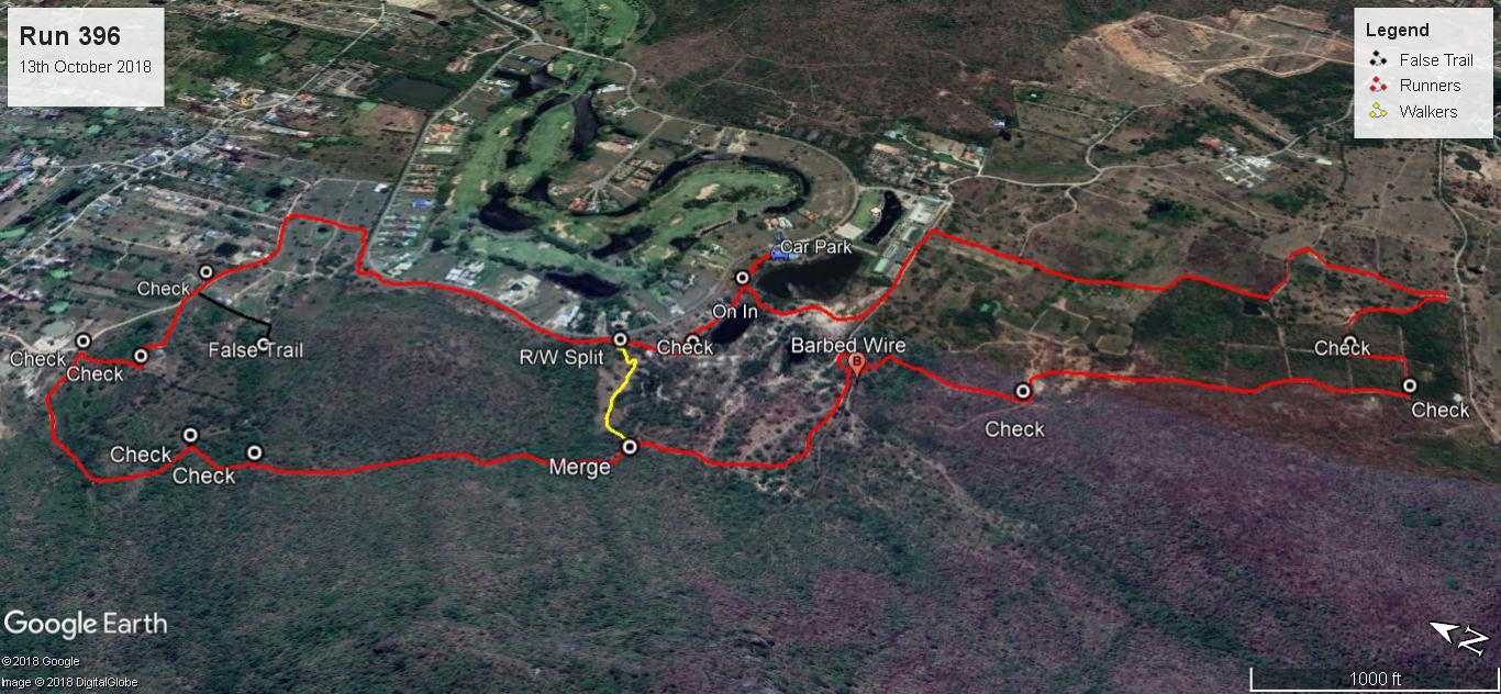
Last Saturdays H2H3 Rambo trail set by Bush Whacker & Hoover for Tinks and Mudman was 10.1 km and took 110:36 min. which included backtracking the long walk trail to find the true trail and finding the RW split in the process.
Elevation: Min 39 m, Max 75 m, Gain/Loss 127 m.
Slope: Assent 16.7%, Decent 12.3%
Start to SW Split: 1.6 km in 16:50 min.
SW Split to RW Split: 2.6 km in 31:06 min. Included back tracking 1.8 km in 21:32 min
RW Split to RW Merge: 3.0 km in 33:10 min.
RW Merge to Finish: 2.9 km in 29:30 min.
The true Rambo Trail would have been 8.8 km
The true Long Walk Trail would have been 5.8 km
Trails went clockwise
Photos by Philippe - click on Info for photo commentary (in French)
GPS Scan by Tinks
Last Saturdays H2H3 Rambo trail set by Bush Whacker & Hoover for Tinks and Mudman was 10.1 km and took 110:36 min. which included backtracking the long walk trail to find the true trail and finding the RW split in the process.
Elevation: Min 39 m, Max 75 m, Gain/Loss 127 m.
Slope: Assent 16.7%, Decent 12.3%
Start to SW Split: 1.6 km in 16:50 min.
SW Split to RW Split: 2.6 km in 31:06 min. Included back tracking 1.8 km in 21:32 min
RW Split to RW Merge: 3.0 km in 33:10 min.
RW Merge to Finish: 2.9 km in 29:30 min.
The true Rambo Trail would have been 8.8 km
The true Long Walk Trail would have been 5.8 km
Trails went clockwise
 RSS Feed