Mudman & Spook with Hash Snacks by Mudlady : Back of Tippawan Village near Wat Samorphrong : 59 hashers attended
Report by Anon & Tinks
Photos by Ballbanger, Dragon Tail and Muddy Joe with a video by Legs Wide Open
Photos by Dragon Tail
Tinks's GPS scan
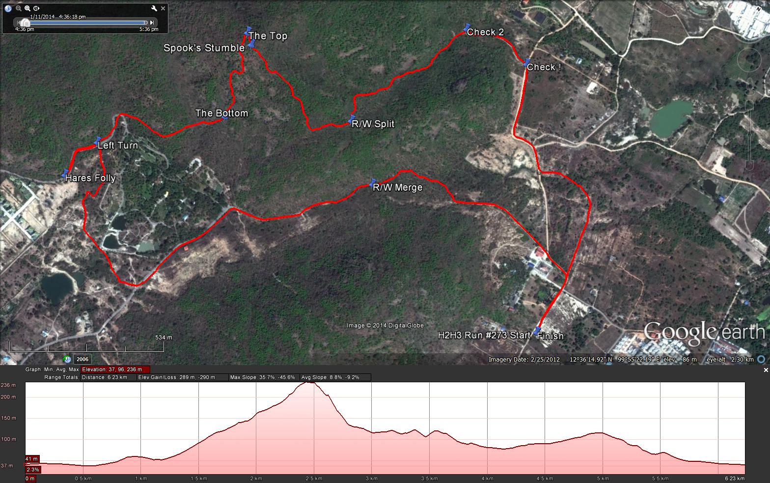
Tinks's GPS commentary - click on Read More
Report by Anon & Tinks
Photos by Ballbanger, Dragon Tail and Muddy Joe with a video by Legs Wide Open
Photos by Dragon Tail
Tinks's GPS scan
Tinks's GPS commentary - click on Read More
- Although I was not at the run last Saturday I did go out today and completed the true runners trail in the presence of Mudman.
- The runners trail was 6.3 km including 340 m to the point flagged as Hares Folly. The trail was very obvious to me this morning so I am unable to understand how you front runners overran the true trail and ended up doing part of my trial from 4 weeks ago.
- Elevation - Min 53 m Max 133 m, Gain 289 m, Loss 289 m,
- Max slope - Ascent 35.7%, Descent 45.6.5%.Route went anti-clockwise
- The runners loop was 3.3 km.
- I took 20:10 min to reach the TOP marker from the R/W Split and 21:3 min going down to the small rock dam (BOTTOM Marker) in the water course. The distance down being 318 m, probably around 500 m in actual distance taking into account the 45% descent
- The R/W split was 1.9 km into the trial and the distance between split and merge is around 300 m and the final in trail from R/W merge to Finish 1.1 km giving a walkers trail of around 3.3 km.
 RSS Feed