Pedalphile & Steve aka Neil Anderthal with Hash Snacks by Plodderphile : 250m up Soi 122 adjacent to the Banyan : 50 hashers attended : Hash Cash balance Bt 40,930
Report by Tinks
Photos by Loose Screw & Golden Delicious
Tinks's GPS scan
Tinks's GPS commentary - click on Read More
Report by Tinks
Photos by Loose Screw & Golden Delicious
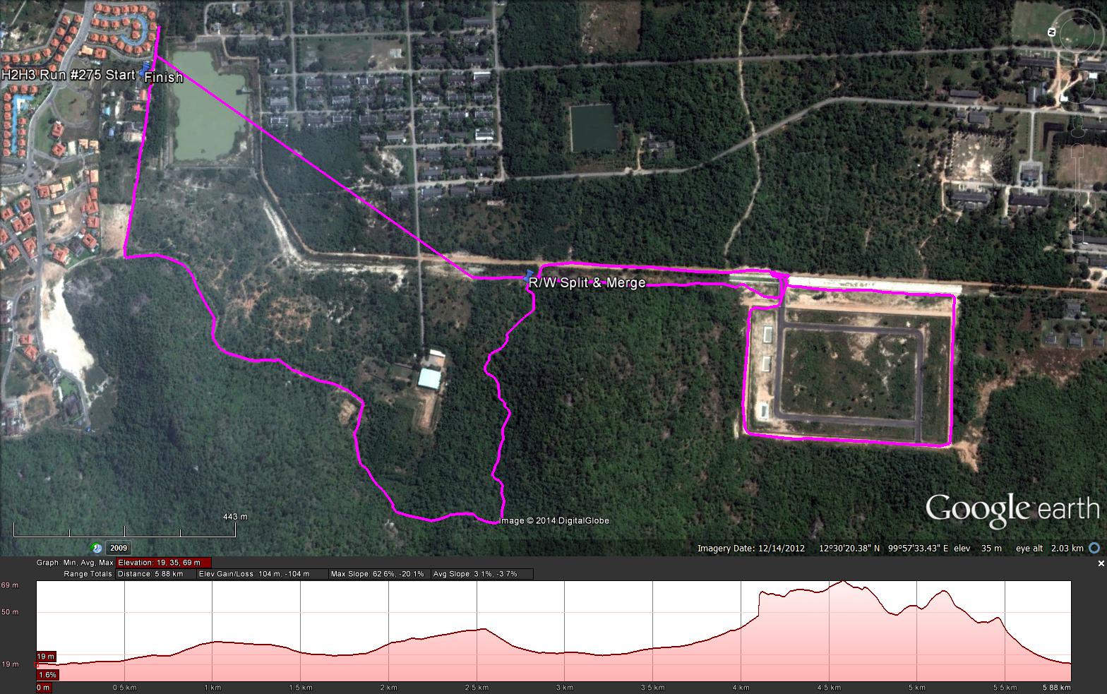
Tinks's GPS scan
Tinks's GPS commentary - click on Read More
- Yesterdays runners trail for me was around 6.66 km in 72:22 min for me
- Elevation - Min 19 m Max 69 m, Gain 104 m, Loss 104 m
- Max slope - Ascent NA%, Descent 20.1%.Route went clockwise
- The runners loop was 2.7 km and took me 24:47 min
- The R/W Split and Merge were the same location.
- Distance from Split/Merge was 2.1 km and took me 20:34
- My GPS failed to record the trail to the R/W Merge so by using a different programme was able to calculate a more true distance of 1.86 km which took me 21:27 min
- So a more realistic distance was 6.66 km in 66:48 min
- The Walkers trail was around 3.96 km
 RSS Feed