Report by Tinks
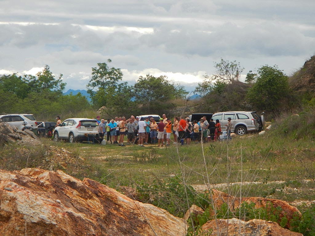
Photos by Ballbanger (slideshow recommended) best viewed in Google Chrome
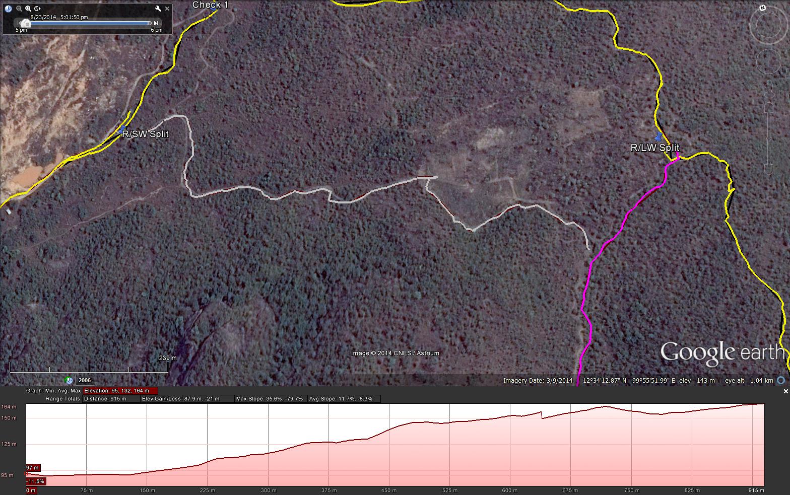
GPS scan by Tinks showing the long walkers trail
GPS scan by Tinks showing the short walkers trail
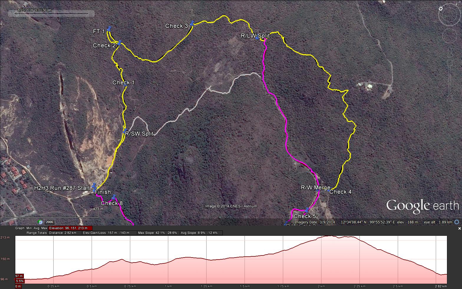
GPS scan by Tinks showing the runners trail
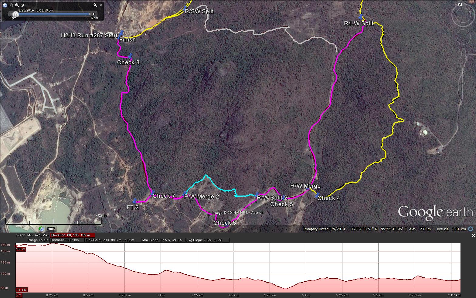
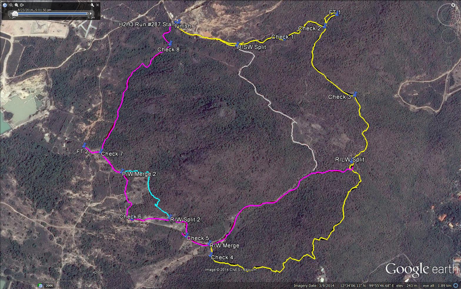
GPS scan by Tinks showing all trails
Tinks's GPS commentary. Essential reading to understand things! - click Read More
Photos by Ballbanger (slideshow recommended) best viewed in Google Chrome
GPS scan by Tinks showing the long walkers trail
GPS scan by Tinks showing the short walkers trail
GPS scan by Tinks showing the runners trail
GPS scan by Tinks showing all trails
Tinks's GPS commentary. Essential reading to understand things! - click Read More
The Short Walk was a total of 3.829 km and followed Yellow to the split then Grey and Magenta to finish.
The Long Walk was 4.626 km and followed the Yellow and Magenta trails
The Runners Trail was 5.026 km if you did not take the Cyan Trail, and 4.968 if you did.
The elevation profile for the Yellow (RT) Trail
Elevation - Min 96 m Max 218 m, Gain 157 m, Loss 143 m,
Max slope - Ascent 42.1%, Descent 28.6%.
The elevation profile for the Magenta (LW) Trail
Elevation - Min 68 m Max 169 m, Gain 89.3 m, Loss 165 m,
Max slope - Ascent 27.5%, Descent 24.8%.
The elevation profile for the Grey (SW) Trail
Elevation - Min 95 m Max 164 m, Gain 87.9 m, Loss 21 m,
All trails went clockwise
 RSS Feed