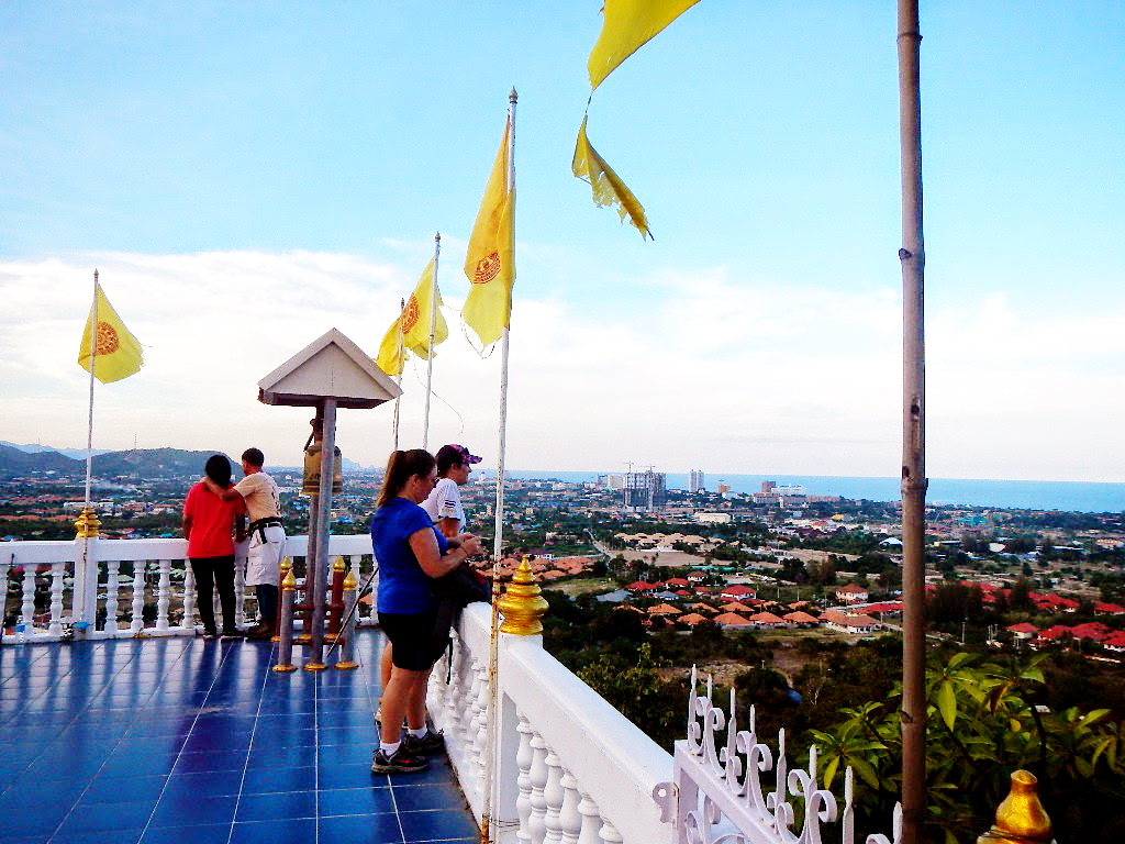
Photos by Ballbanger
Photos by Dragon Tail
Report by Tinks
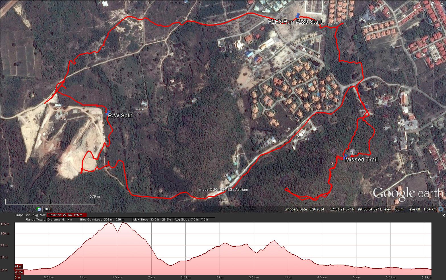
GPS scan by Tinks (where he went on the run)
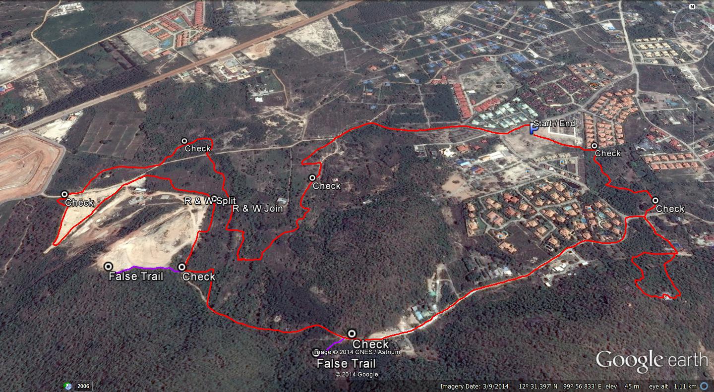
GPS scan by Hugmanannygoat (where the hares laid the trail)
Tinks's GPS commentary with further comments by Hugs - click on Read More
Photos by Dragon Tail
Report by Tinks
GPS scan by Tinks (where he went on the run)
GPS scan by Hugmanannygoat (where the hares laid the trail)
Tinks's GPS commentary with further comments by Hugs - click on Read More
Yesterdays Hash runners trail for me was 6.2 km in 81:32 min.
Elevation - Min 22 m Max 125 m, Gain 226 m, Loss 226 m.
Max slope - Ascent 33.0%, Descent 26.9%.Route went clockwise
Distance to R/W - 4.2 km for me and Screwdriver who went off trail at the Stuppa for a round trip distance of 812 m in 12:51 min.
Therefore the R/W split was around 3.4 km into the trail which if I recall was not as advised by the Hare Jock Twat.
Looks like if Screwdriver and I continued on are downward path we would have come out on the trial having saved around 1.2 km
Not knowing where the R/W merge I am unable to provide any further information.
Will wait to see the Hares GPS route.
-------------------------------------------------------------------------------------------------------------------
Further comments by Hugmanannygoat
See attached for the correct route including False Trails. The runners trail (excluding false trails) would have been 6k and the walkers trail 4.6k. The distance to the R/W split would be 3.1k just as Jock Twat had said, however, JT did not consider that our GM and Screwdriver would miss the paper and go up the hill travelling nearly half a km before realising they were off paper and I believe Tink's also had to do the falsey up the hill from the unbroken check next to the quarry so it doesn't surprise me that he thinks it was 3.4km and not 3.1km to the split.
As for missing the merge - there was paper where Tink's and Screwdriver once again lost the paper trail near the entrance to the quarry, but unfortunately the quality of the shredded paper was grey / creamy yellow which blended into the terrain like camofladge. They then found paper but for a third time lost it, thereby failing to find the R/W merge. From now on I'm going to use only white paper that is easy seen, perhaps that will stop Tink's from going off trail so often!
 RSS Feed