Photos by Ballbanger (recommended click on first photo then view slideshow)
Photos by Dragon Tail
Report by Scotch Tape
GPS scan by Tinks
Tinks's GPS commentary - click on Read More
Photos by Dragon Tail
Report by Scotch Tape
GPS scan by Tinks
Tinks's GPS commentary - click on Read More
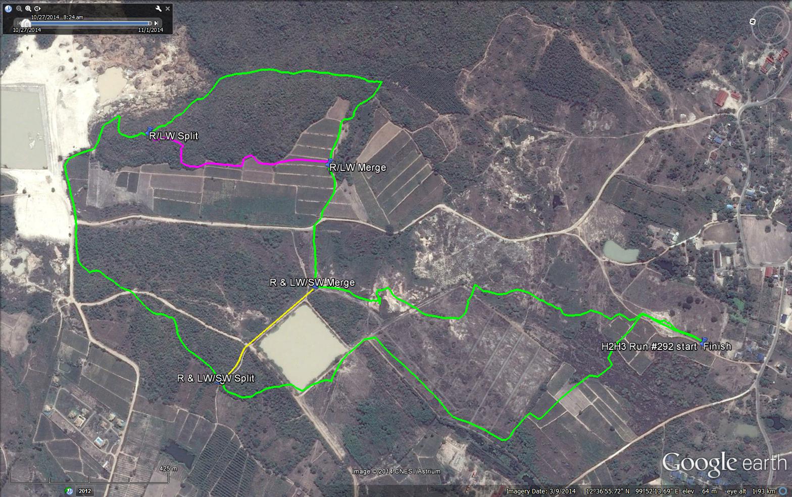
Runners - Green Trail – 5.5 km
Elevation - Min 52 m Max 137 m, Gain 94.7 m, Loss 94.7 m.
Max slope - Ascent 18.1%, Descent 16.5%.
Long Walk – Magenta Short Cut – 5 km
Elevation - Min 23 m Max 94 m.
Max slope - Ascent 18.1%, Descent 29.4%.
Short Walk – Yellow Short Cut – 3.4 km
Elevation - Min 23 m Max 62 m.
All routes went clockwise
 RSS Feed