Report by HYHMY and Tinks
Photos by Cathusalem (recommended click on first photo then use slideshow)
GPS scan by Tinks
Tinks's GPS commentary - click on Read More
Photos by Cathusalem (recommended click on first photo then use slideshow)
GPS scan by Tinks
Tinks's GPS commentary - click on Read More
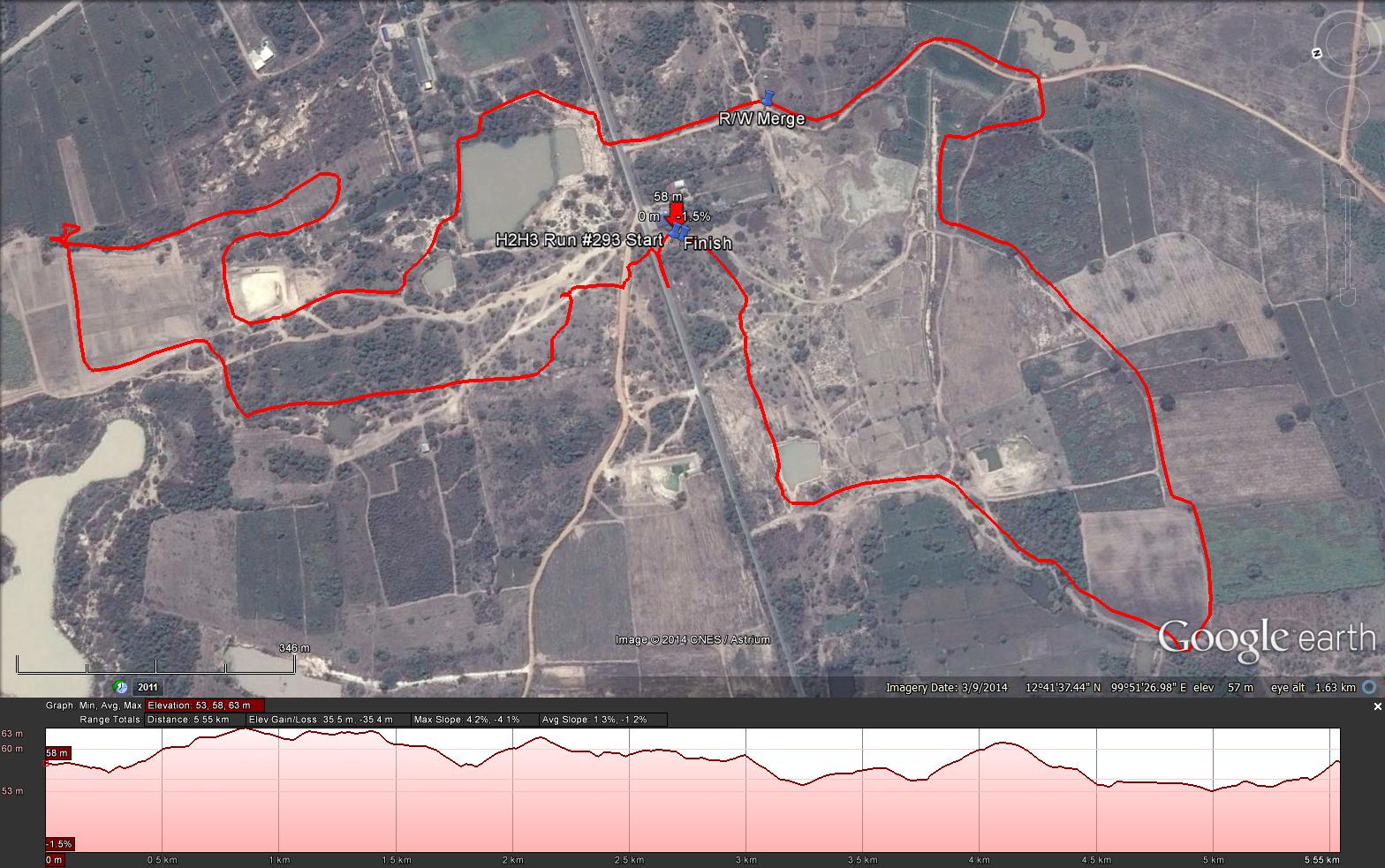
Yesterdays Hash runners trail for me was 5.6 km in 65:20 min.
Elevation - Min 53 m Max 63 m, Gain 35.5 m, Loss 35.5 m.
Max slope - Ascent 4.2%, Descent 4.1%.Route went clockwise
Approximate Distance to R/W Merge – 3.1 km in 38:20 min.
The Runners Loop - 3.1 km in 38:.20 min.
Distance from R/W Merge to Finish: 2.5 km in 27:00
Estimated distance between Start and R/W Merge: 600 m.
 RSS Feed