Photos by Ballbanger (recommend click on first photo then slideshow)
More photos by Ballbanger
Report by Butt Out
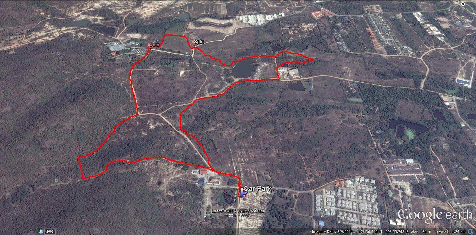
GPS scan of walkers trail by Hugmanannygoat - 4.26 km anti-clockwise
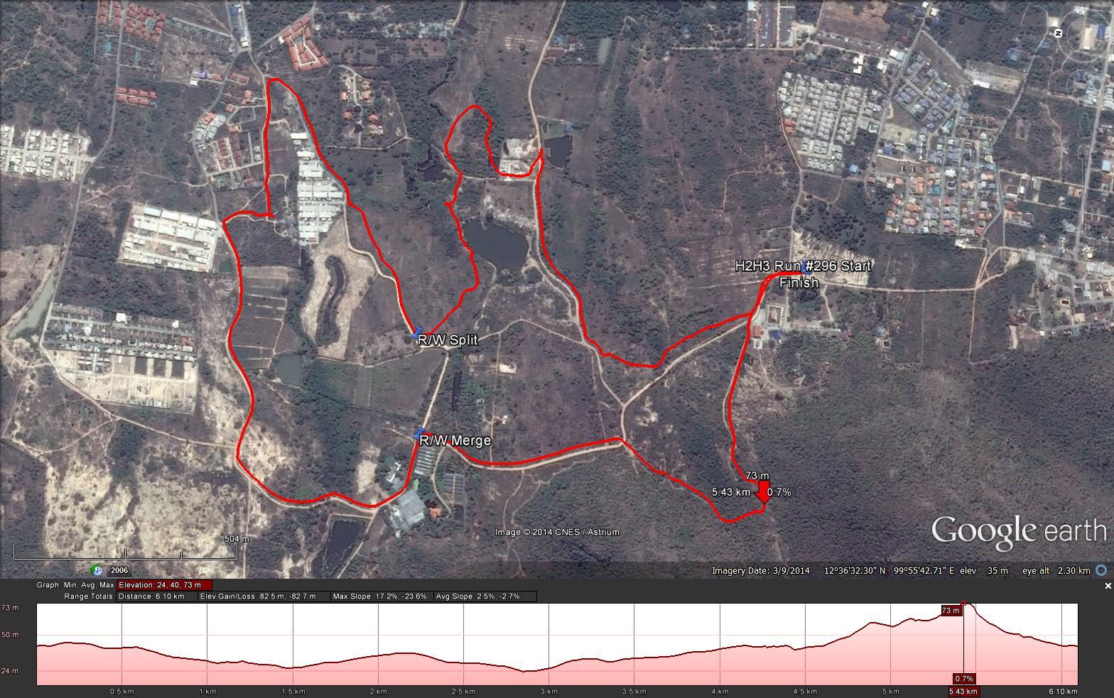
GPS scan of runners trail by Tinks
Tinks's GPS commentary - click on Read More
More photos by Ballbanger
Report by Butt Out
GPS scan of walkers trail by Hugmanannygoat - 4.26 km anti-clockwise
GPS scan of runners trail by Tinks
Tinks's GPS commentary - click on Read More
Yesterdays Hash runners trail for me was 6.2 km in 65:37 min.
Elevation - Min 24 m Max 73 m, Gain/Loss 82.5 m.
Max slope - Ascent 17.2%, Descent 23.6%
Route went anti-clockwise
Distance to R/W Split 2.2 km
Runners Loop : 2.4 km
R/W Merge to Finish: 1.6 km
R/W Split to R/W Merge: 400 m
Walkers trail: 4.2 km
Elevation - Min 24 m Max 73 m, Gain/Loss 82.5 m.
Max slope - Ascent 17.2%, Descent 23.6%
Route went anti-clockwise
Distance to R/W Split 2.2 km
Runners Loop : 2.4 km
R/W Merge to Finish: 1.6 km
R/W Split to R/W Merge: 400 m
Walkers trail: 4.2 km
 RSS Feed