Hash Notes by Tinks
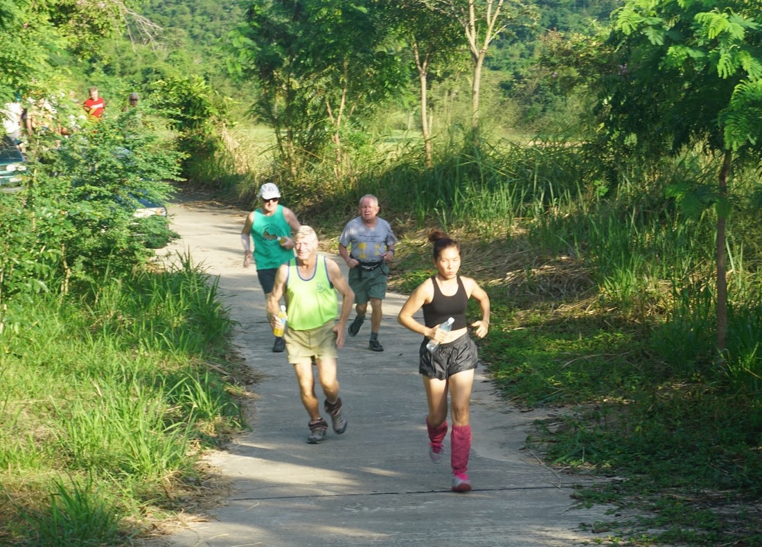
Photos by Hugmanannygoat (recommended click on first photo then slideshow)
Photos by Dragon Tail
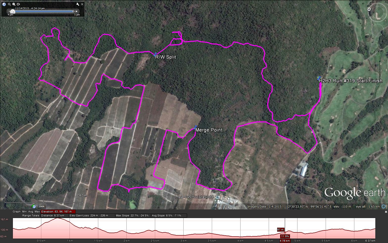
GPS scan by Tinks (where he went)
Yesterdays Runners trail for me was 6.4 km in 84:20 min.
Elevation - Min 63 m Max 167 m, Gain/Loss 225 m.
Max slope - Ascent 22.7%, Descent 24.5%.
Route went anti-clockwise
Distance to R/W Split: 1.6 km including 364 m of trying to break check. The trail was 160 m from the Check
Runners loop: 3.2 km to the all trail merge. Did not see Long Walk split.
R/W Merge to Finish: 1.5 k
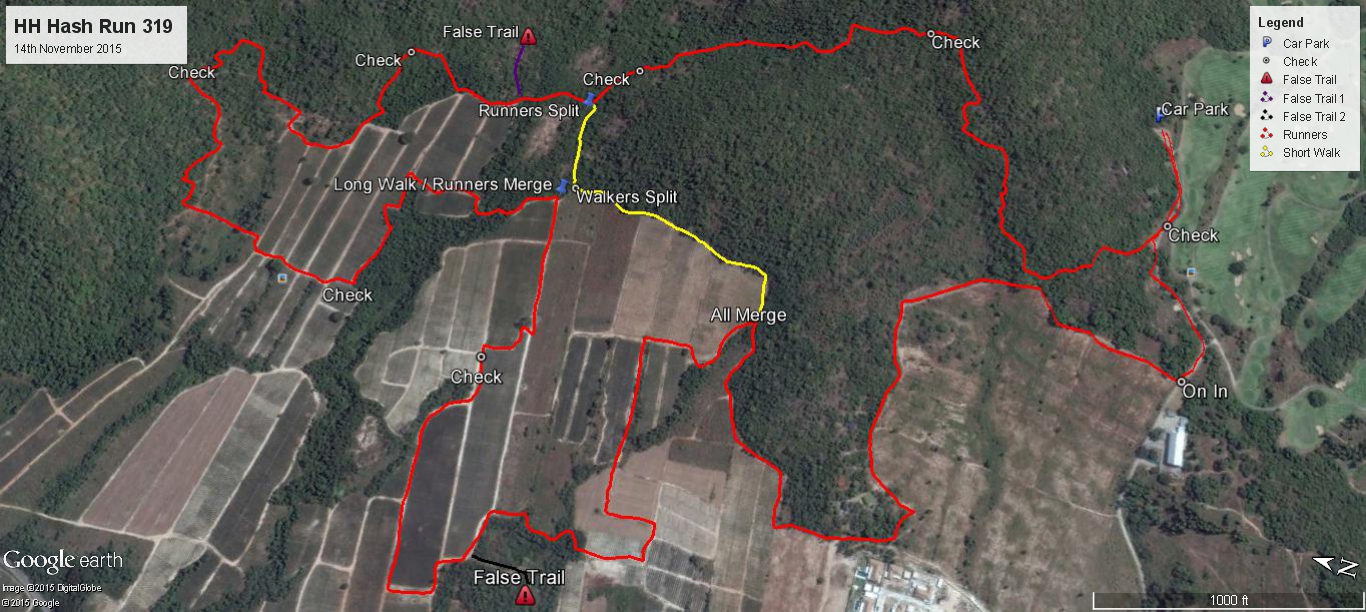
GPS scan of trail as planned by the hares
Runners trail minus false trails 6.37 km
Long Walkers trail minus false trail 4.87 km
Short walkers Trail 3.6 km
Photos by Hugmanannygoat (recommended click on first photo then slideshow)
Photos by Dragon Tail
GPS scan by Tinks (where he went)
Yesterdays Runners trail for me was 6.4 km in 84:20 min.
Elevation - Min 63 m Max 167 m, Gain/Loss 225 m.
Max slope - Ascent 22.7%, Descent 24.5%.
Route went anti-clockwise
Distance to R/W Split: 1.6 km including 364 m of trying to break check. The trail was 160 m from the Check
Runners loop: 3.2 km to the all trail merge. Did not see Long Walk split.
R/W Merge to Finish: 1.5 k
GPS scan of trail as planned by the hares
Runners trail minus false trails 6.37 km
Long Walkers trail minus false trail 4.87 km
Short walkers Trail 3.6 km
 RSS Feed