Hash Notes by Tinks
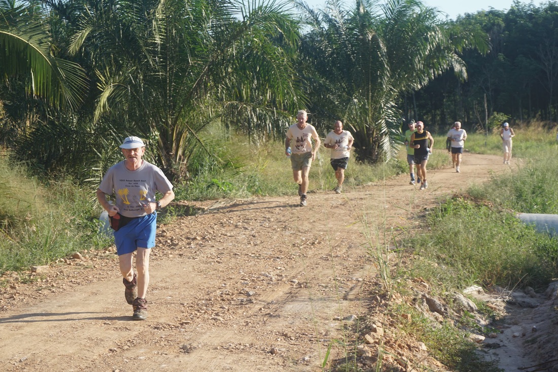
Photos by Hugmanannygoat
Photos by Dragon Tail
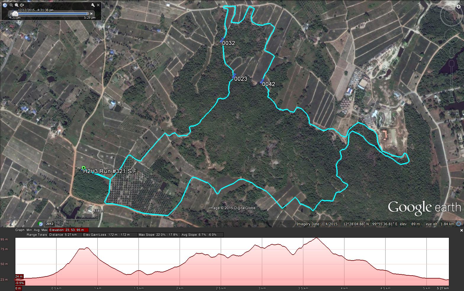
GPS scan by Tinks
Yesterdays Runners trail for me was 5.3 km in 58:04 min.
Elevation - Min 23 m Max 95 m, Gain/Loss 172 m.
Max slope - Ascent 22.0%, Descent 17.8%.
Route went clockwise
Distance to R/W Split (0023) 0.95 km
Distance to R/SW Split (0032) 200 m
Distance to R/LW Merge (0042) 0.95 km
Distance to Finish 3.2 km
Distance for Long Walk 4.3 km
Photos by Hugmanannygoat
Photos by Dragon Tail
GPS scan by Tinks
Yesterdays Runners trail for me was 5.3 km in 58:04 min.
Elevation - Min 23 m Max 95 m, Gain/Loss 172 m.
Max slope - Ascent 22.0%, Descent 17.8%.
Route went clockwise
Distance to R/W Split (0023) 0.95 km
Distance to R/SW Split (0032) 200 m
Distance to R/LW Merge (0042) 0.95 km
Distance to Finish 3.2 km
Distance for Long Walk 4.3 km
 RSS Feed