Hash Notes by Cathusalem
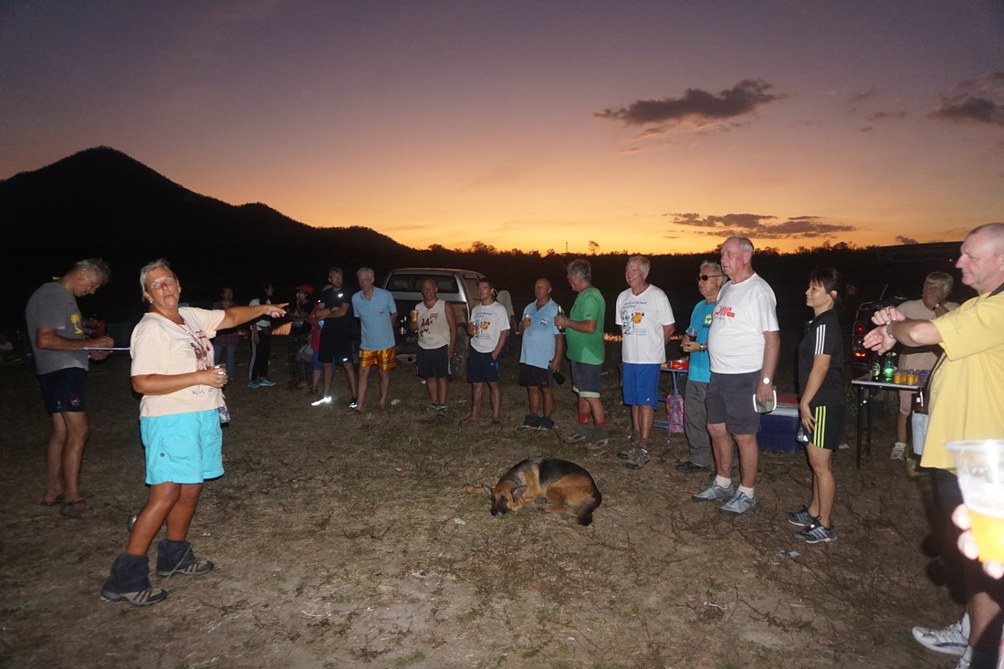
Photos by Hugmanannygoat - best viewed by clicking F11 for full screen
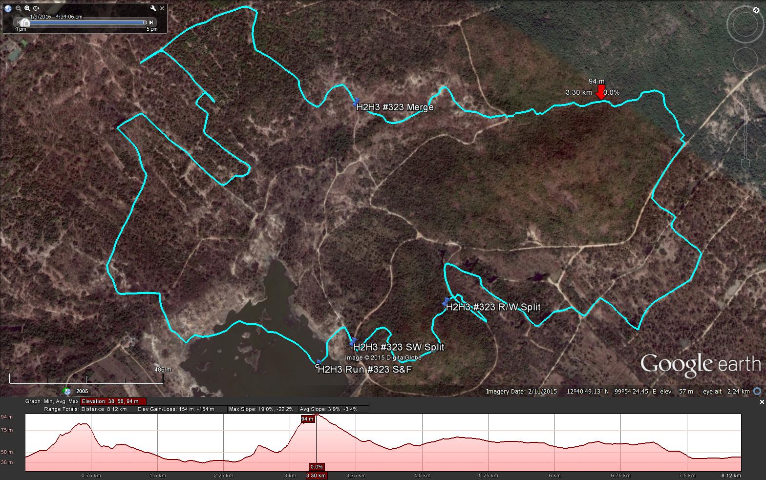
GPS scan by Tinks
Yesterdays Runners trail for me was 8.2 km in 83:37 min.
Elevation - Min 38 m Max 94 m, Gain/Loss 154 m.
Max slope - Ascent 19.0%, Descent 22.2%.
Route went anti-clockwise
Distance to SW Split 0.2 km
Distance to LW Split 0.6 km
Distance to Merge 3.5 km
Distance to Finish 3.9 km
Photos by Hugmanannygoat - best viewed by clicking F11 for full screen
GPS scan by Tinks
Yesterdays Runners trail for me was 8.2 km in 83:37 min.
Elevation - Min 38 m Max 94 m, Gain/Loss 154 m.
Max slope - Ascent 19.0%, Descent 22.2%.
Route went anti-clockwise
Distance to SW Split 0.2 km
Distance to LW Split 0.6 km
Distance to Merge 3.5 km
Distance to Finish 3.9 km
 RSS Feed