Photos by Ballbanger (slideshow recommended) best viewed in Google Chrome
Photos by Dragon Tail (slideshow recommended) best viewed in Google Chrome
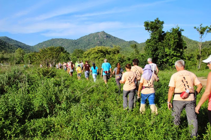
Photos by Hugmanannygoat
Report by Cathusalem
GPS scan by Hugmanannygoat showing the walkers trail with checks and false trails
GPS scan by Hugmanannygoat showing the runners and walkers trails ditto
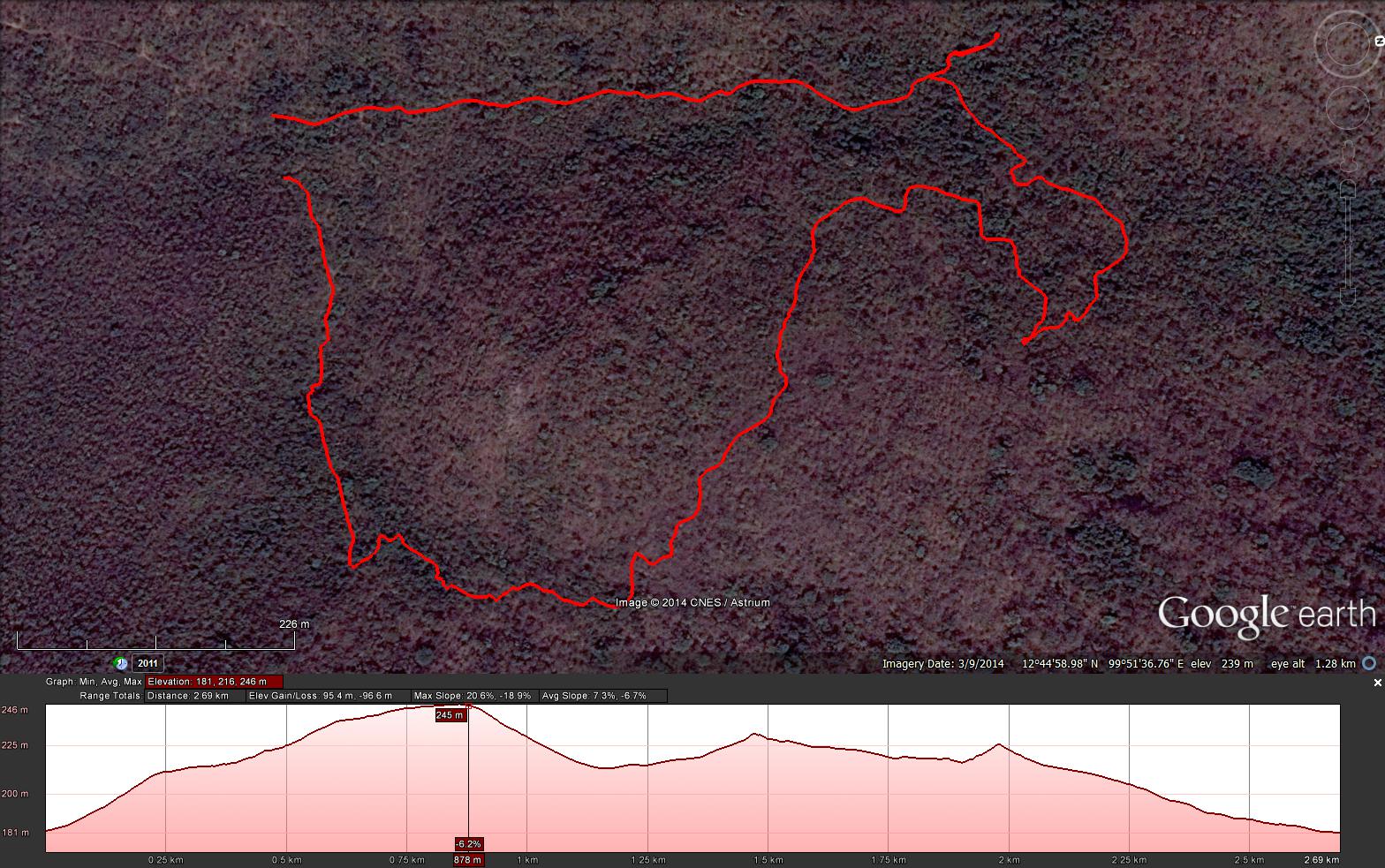
GPS scan by Tinks (based on Hugmanannygoat's) showing the "ghost" runners trail
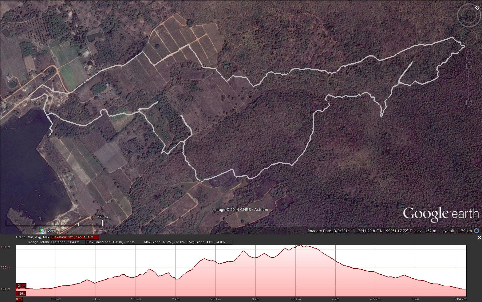
GPS scan by Tinks (based on Hugmanannygoat's) showing the walkers trail
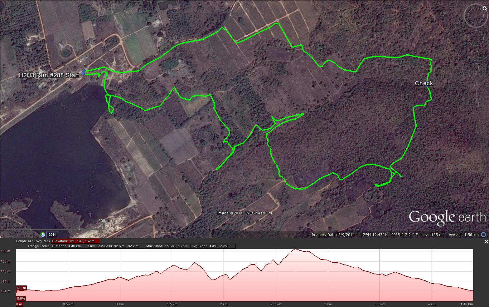
GPS scan by Tinks showing the shorter trail he and several others took by mistake
GPS scan by Tinks showing all 3 trails, combining his scan with Hugmanannygoat's
Tinks's GPS commentary - click on Read More
Photos by Dragon Tail (slideshow recommended) best viewed in Google Chrome
Photos by Hugmanannygoat
Report by Cathusalem
GPS scan by Hugmanannygoat showing the walkers trail with checks and false trails
GPS scan by Hugmanannygoat showing the runners and walkers trails ditto
GPS scan by Tinks (based on Hugmanannygoat's) showing the "ghost" runners trail
GPS scan by Tinks (based on Hugmanannygoat's) showing the walkers trail
GPS scan by Tinks showing the shorter trail he and several others took by mistake
GPS scan by Tinks showing all 3 trails, combining his scan with Hugmanannygoat's
Tinks's GPS commentary - click on Read More
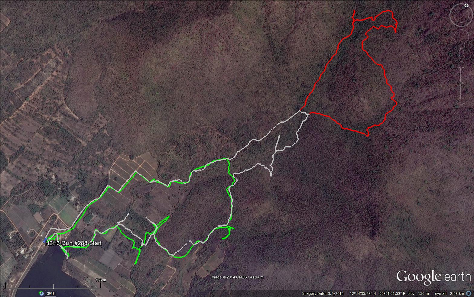
Following last Saturdays sterling efforts by the Hares in their final act of the Lake Side Trilogy and the unfortunate breaking of a check on to the incoming trail I managed to miss the full length of the walkers and avoid the R/W split.
As a result my trail (Green) was only 4.4 km in 58:32 min.
Elevation - Min 121 m Max 162 m, Gain 92 m, Loss 92 m,
Max slope - Ascent 15.6%, Descent 16.5%.
The Walkers Trail as laid by the Hares (Grey) based on Google Earth profile was 5.64 km
Elevation - Min 121 m Max 181 m, Gain 126 m, Loss 126 m,
Max slope - Ascent 18.3%, Descent 18.0%.
The Runners Loop as laid by the Hares (Red) based on Google Earth profile was 2.69 km
Elevation - Min 181 m Max 246 m, Gain 95.4 m, Loss 96.68 m,
Max slope - Ascent 20.6%, Descent 18.9%.
All trails went anti-clockwise
 RSS Feed